8 Weekend Hikes Near Taipei You Can Reach by MRT or Bus
By Raytio Ray
Hiking near Taipei: eight weekend trails ranked easy to hard, with the exact MRT exit or bus number, time, difficulty, highlights and one honest downside.
Hiking near Taipei: you just need the right first trail
Within 30 to 90 minutes of the city by MRT, bus or local train you have volcanic peaks, grassland ridges, coastal cliffs and old stone trails. None of the eight hikes below needs a car, which makes hiking near Taipei one of the best parts of living here.
They're sorted from easiest to hardest. If you want gentler outings like hot springs, old streets and bike paths instead, see our guide to weekend and holiday escapes from Taipei without a car.
Our picks: for your first weekend, do Elephant Mountain late afternoon, then Qixing Mountain the following weekend. For a properly hard day once you know your legs, do Huangdidian.
1. Elephant Mountain (象山): the 30 minute classic

Photo: Любарский Сергей Николаевич via Wikimedia Commons, CC BY-SA 4.0
- Getting there: MRT Xiangshan station (Red line terminus), Exit 2, then about 5 minutes on foot to the trailhead.
- Distance and time: about 1.5 km to the main viewing rocks, 20 to 40 minutes up.
- Difficulty: easy, but it's almost all stairs.
- Best for: your first week, sunset, visitors.
- Highlight: the closest, cleanest Taipei 101 view in the city.
- Honest downside: at sunset on weekends the Six Giant Rocks are packed shoulder to shoulder. Go an hour before sunset or on a weekday.
2. Maokong tea trails (貓空): easy hills with tea at the end
- Getting there: MRT Taipei Zoo station, then the Maokong Gondola to Maokong station. Or hike up from Zhinan Temple and ride the gondola down.
- Distance and time: pick your own loop; 1 to 3 hours of gentle paths between tea farms.
- Difficulty: easy.
- Best for: a relaxed afternoon with friends who don't "hike".
- Highlight: finishing at a tea house with a valley view.
- Honest downside: the gondola usually closes on Mondays for maintenance and sometimes for longer overhauls, and weekend queues at the bottom can be long. Check the Maokong Gondola site before you go.
3. Bitoujiao Cape Trail (鼻頭角): coastal cliffs and a lighthouse
- Getting there: local train to Ruifang, then bus 886 to the Bitoujiao stop, or the Gold Fulong shuttle 856 to the Bitou stop. From Keelung station, bus 791 (towards Fulong) also stops at Bitoujiao.
- Distance and time: about 3 to 5 km depending on the loop, 2 to 3 hours.
- Difficulty: easy to moderate.
- Best for: people who want the sea, not forest.
- Highlight: a ridge walk along cliffs above bright blue water, ending at a small white lighthouse.
- Honest downside: almost no shade. On a sunny day you'll cook, so bring a hat and more water than you think.
4. Teapot Mountain (茶壺山): short, steep, huge views
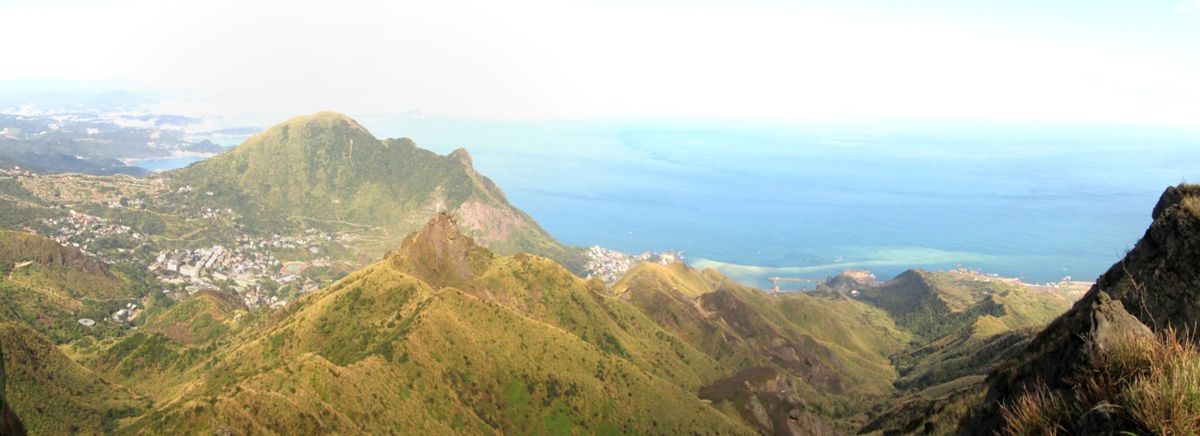
Photo: Kuanyui via Wikimedia Commons, CC BY-SA 3.0
- Getting there: bus 1062 (Keelung Bus) from MRT Zhongxiao Fuxing station, Exit 1, to the last stop at Quanji Temple in Jinguashi. The ride is about 90 minutes.
- Distance and time: around 2 to 3 hours return from Quanji Temple. Strong hikers continue along the ridge to Banping Mountain.
- Difficulty: moderate. The final bit into the "teapot" rock uses fixed ropes.
- Best for: the best view per hour of effort on this list.
- Highlight: looking down over Jinguashi, the old mining slopes and the Yin Yang Sea.
- Honest downside: on misty days you see absolutely nothing, and this coast is misty a lot from November to March. Check the forecast for Ruifang, not Taipei.
5. Four Beasts Mountain (四獸山): a real hike inside the city
- Getting there: MRT Yongchun station (Blue line), then about 10 to 15 minutes on foot to Fengtian Temple and the Tiger Mountain trail. Finish by coming down Elephant Mountain to Xiangshan station.
- Distance and time: roughly 8 km point to point, 3 to 5 hours with stops.
- Difficulty: moderate. Lots of stairs, some up and down between peaks.
- Best for: a proper workout without leaving the MRT network.
- Highlight: Tiger, Leopard, Lion and Elephant peaks in one day, with a quiet temple section in the middle.
- Honest downside: a web of side trails and temples makes it easy to take a wrong turn. Download the route in Hiking Biji before you start.
6. Caoling Historic Trail (草嶺古道): history and grassland
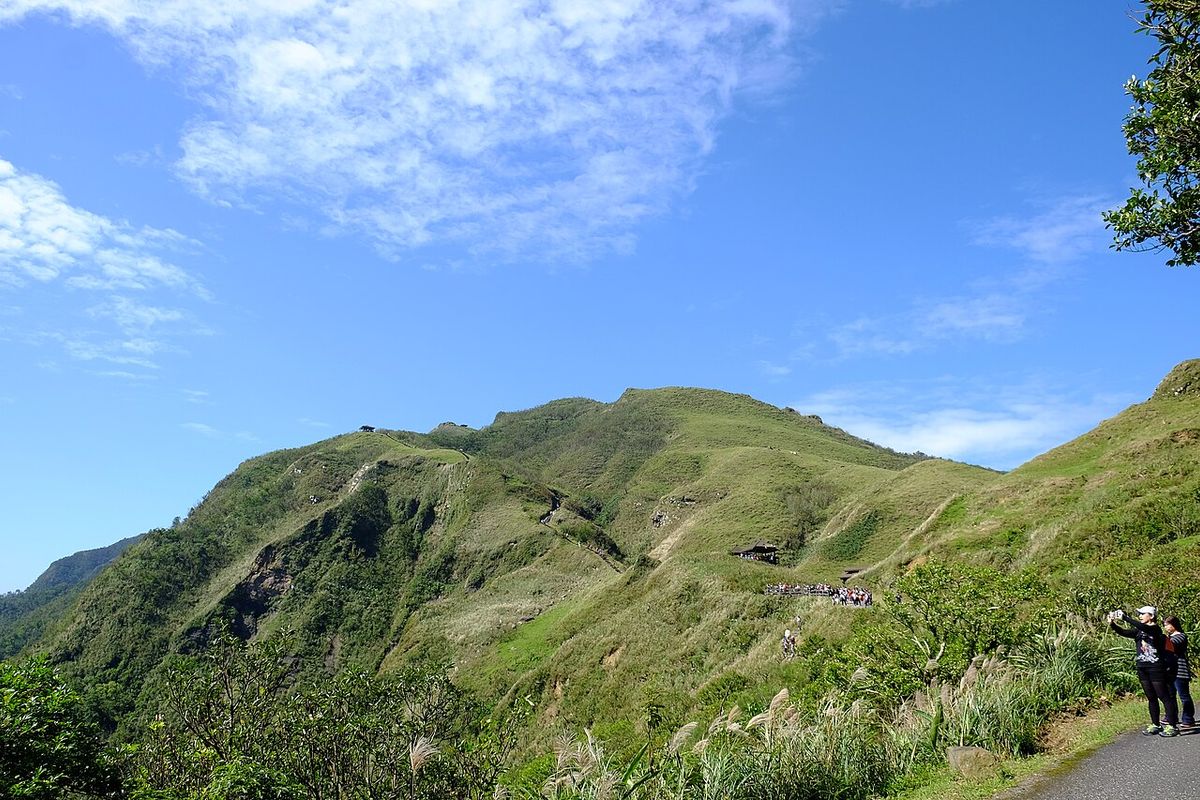
Photo: Taiwankengo via Wikimedia Commons, CC BY-SA 4.0
- Getting there: Taiwan Railway from Taipei Main Station to Fulong (start) and back from Dali (finish), or the reverse.
- Distance and time: about 8.5 km station to station, 3.5 to 4.5 hours.
- Difficulty: moderate, roughly 400 m of climbing on old stone steps.
- Best for: a full day out with a train ride both ways.
- Highlight: the Qing dynasty trail over the pass, and silver grass (芒草) on the ridge in late October to November.
- Honest downside: local trains on this line are slow and not frequent. Check the return train from Dali on the Taiwan Railway app before you set off, or you'll wait an hour by the highway.
7. Qixing Mountain (七星山): Taipei's highest peak
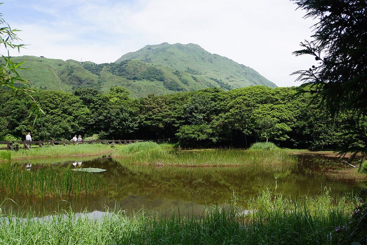
Photo: lienyuan lee via Wikimedia Commons, CC BY 3.0
- Getting there: bus R5 (紅5) from MRT Jiantan station to the Yangmingshan bus terminal (30 to 50 minutes depending on traffic), or bus 260 from near Taipei Main Station. At the terminal, switch to the park's 108 loop shuttle and get off at Lengshuikeng (冷水坑) to start, or Xiaoyoukeng (小油坑) for the shorter, steeper approach. We go up from Lengshuikeng and down to Xiaoyoukeng.
- Distance and time: Lengshuikeng to the summit and down to Xiaoyoukeng is about 4 km, 2.5 to 3.5 hours.
- Difficulty: moderate to hard. About 500 m of stone stairs.
- Best for: the "real mountain" weekend after Elephant Mountain.
- Highlight: the 1,120 m main peak, with views to the coast on a clear day, and steaming sulfur vents at Xiaoyoukeng on the way down.
- Honest downside: the summit is exposed and windy, and weather on Yangmingshan changes fast. It can be 8°C and foggy up top when Taipei is 18°C. Bring a jacket even if the city feels warm.
8. Huangdidian (皇帝殿): the rocky ridge for a harder day
- Getting there: bus 666 from MRT Jingmei or Muzha towards Shiding. Make sure the bus is signed for Huangdidian (皇帝殿) or Huafan University (華梵大學), because some 666 runs end at Shiding Old Street and add a long road walk.
- Distance and time: 3 to 5 hours depending on whether you do the east or west peak loop.
- Difficulty: hard. Narrow sandstone ridges with fixed ropes and chains, some sections with long drops on both sides.
- Best for: experienced hikers with no fear of heights.
- Highlight: walking a knife-edge rock spine above green valleys.
- Honest downside: it is genuinely dangerous when wet. Skip it after rain, wear shoes with real grip, and don't bring a nervous first-timer. Buses back are infrequent, so note the return times when you arrive.
Practical tips before you go
When to hike. October to April is the season. From May to September, mornings are fine but afternoon thunderstorms are almost daily in the mountains, and typhoons can close trails. In summer, start by 8 a.m. and be off exposed ridges by early afternoon; that also beats the weekend crowds. If a typhoon warning is up, stay home; see our guide to typhoon days in Taiwan.
Heat and water. Humidity is the real enemy. For a 3 hour hike in warm weather, carry at least 1.5 to 2 liters per person plus a sports drink or salt tablets. Buy everything at a 7-Eleven or FamilyMart near the MRT or bus stop, because there's usually nothing at the trailhead. More on what convenience stores can do for you in our convenience store guide.
Wildlife. Snakes live on every trail on this list, including venomous ones like the green bamboo viper. Stay on the path, keep hands out of grass and crevices, and give any snake space. Wasps are more of a risk than snakes, especially in autumn on Yangmingshan: if you hear buzzing near a bush, back off quietly and don't swat. Formosan macaques show up on some trails; never feed them (it's illegal) and keep food out of sight.
Apps. Use Hiking Biji (健行筆記) for trail maps and recent conditions posted by Taiwanese hikers; Google Translate's camera handles the Chinese. Google Maps is reliable for bus times and stops, and the Bus+ or TaipeiBus apps show live arrivals.
Rain gear and shoes. Pack a light rain jacket year round. Trails here are stone steps that turn slick with moss and rain, so shoes with good grip matter more than expensive hiking boots.
Money. Top up your EasyCard before you leave the city. There may be no store to top up near the trailhead. Our MRT and EasyCard guide covers how to top up.
Tell someone. For Qixing Mountain and Huangdidian, send a friend your route and expected return time. Taiwan's emergency number is 119 for rescue; save a note of it with the other emergency numbers.
Living near the trails
Apartments around Xiangshan, Yongchun, Muzha or Tianmu put real hikes within walking distance of home. If you're still looking for a place, TRA helps foreigners find apartments in Taipei, and we're happy to factor in "near the mountains" when we search. See our services.